

Untitled Storyboard


Siužetinės Linijos Tekstas
- Skaidrė: 1
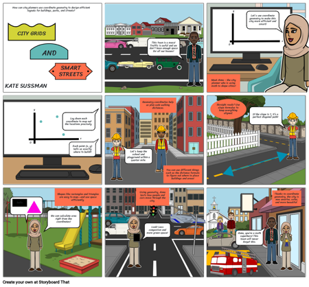
- How can city planners use coordinate geometry to design efficient layouts for buildings, parks, and streets?
- CITY GRIDS
- AND
- KATE SUSSMAN
- Skaidrė: 2
- This town is a mess! Traffic is awful and we don't have enough space for all our houses!
- Skaidrė: 3
- y
- Let's use coordinate geometry to make this city more efficient and smart!
- x
- 0
- Skaidrė: 4
- SMART STREETS
- y
- HELLO
- Lay down each coordinate to map out the locations precisely.
- x
- 0
- Each point (x, y) tells us exactly where to build!!
- Skaidrė: 5
- Geometry coordinates help us plan safe walking distances.
- Let's keep the school and playground within a quarter mile.
- Skaidrė: 6
- Meet Anna - the city planner who is using math to shape cities!
- Straight roads? Use slope formulas to keep everything aligned.
- If the slope is 1, it’s a perfect diagonal path!
- Skaidrė: 7
- Shapes like rectangles and triangles are easy to map—and use space efficiently.
- hello
- hello
- hi
- We can calculate area right from the coordinates!
- Skaidrė: 8
- You can use different things such as the distance formula to figure out where to place buildings and areas!
- Using geometry, Anna tests how people and cars move through the city.
- Look! Less congestion and more green space!
- Skaidrė: 9
- Thanks to coordinate geometry, the city is now smarter, safer, and more beautiful.
- Anna, you’re a math superhero! This town will never forget this.