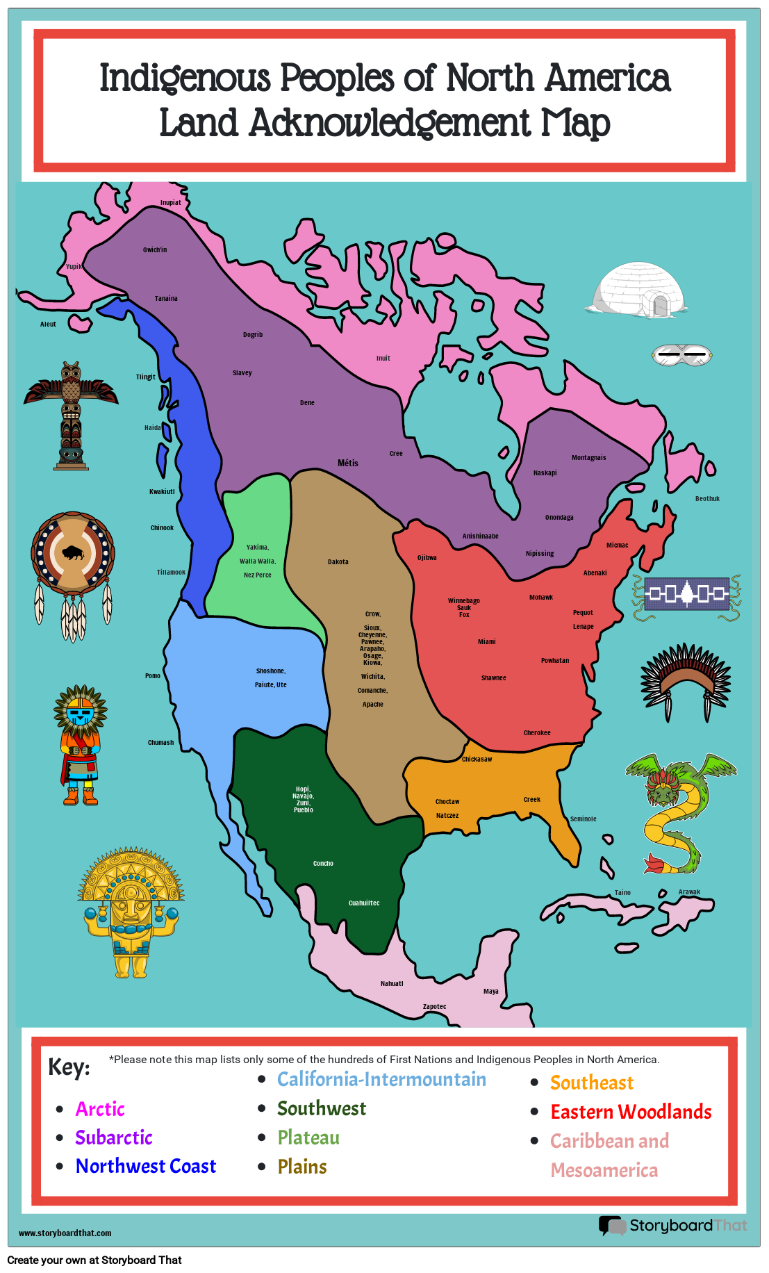
Indigenous Peoples of North America, Land Acknowledgement Map

القصة المصورة الوصف
Students can label the locations of Indigenous groups who called North America home before the European explorers.
نص القصة المصورة
- Aleut
- Indigenous Peoples of North AmericaLand Acknowledgement Map
- Yupik
- Tlingit
- Gwich'in
- Haida
- Pomo
- Kwakiutl
- Chinook
- Tanaina
- Tillamook
- Inupiat
- Slavey
- Yakima,Walla Walla,Nez Perce
- Dogrib
- Shoshone, Paiute, Ute
- Dene
- Dakota
- Métis
- Crow,Sioux,Cheyenne,Pawnee,Arapaho,Osage,Kiowa,Wichita,Comanche,Apache
- Inuit
- Cree
- Ojibwa
- WinnebagoSaukFox
- Anishinaabe
- Miami
- Shawnee
- Nipissing
- Mohawk
- Naskapi
- Powhatan
- Onondaga
- PequotLenape
- Montagnais
- Abenaki
- Micmac
- Beothuk
- .
- Key:ArcticSubarcticNorthwest Coast
- *Please note this map lists only some of the hundreds of First Nations and Indigenous Peoples in North America.
- Chumash
- California-IntermountainSouthwestPlateauPlains
- Hopi, Navajo, Zuni, Pueblo
- Concho
- Cuahuiltec
- Nahuatl
- Zapotec
- ChoctawNatczez
- Chickasaw
- Maya
- Creek
- Cherokee
- SoutheastEastern WoodlandsCaribbean and Mesoamerica
- Seminole
- Taino
- Arawak
تم إنشاء أكثر من 30 مليون من القصص المصورة
لا توجد تنزيلات ولا بطاقة ائتمان ولا حاجة إلى تسجيل الدخول للمحاولة!
